When greenhouse effect and global warming aren't liable for environmental disaster ...
It's very very sad the story of one of the greatest lake of the Earth: the Aral Sea. Located in Central Asia, between borders of North Uzbekistan and South-West Kazakhstan, was until '60 the Fourth-size worldwide lake, after Caspian Sea, Superior Lake and Victoria Lake.
Today its surface is 75% smaller, because of the decrease of water flow of the rivers that feed it (the Amu Darya and the Syr Darya) due to the crazy project of Sovietic Government that since '70 starts to bring out two rivers so much water to flush cotton fields forcedly created in surrounding area. So the amount of water remaining in two rivers wasn't enough to balance natural evaporation of the lake, belonging in one of the most arid area of the world. Therefore the lake basin is strongly downsizing and today they can be observed two distinct lakes, the Little Aral to the North and the Great Aral to the South, fully separated. International effots attempt to save the lake basin, especially Little Aral part. After some drainage intervention in 2005 Little Aral has been fully separated by South part with construction of Kokaral dam and rejoined again with Syr Darya river. Even if the water flow is moderate, in some villages the fishing activities are restarted and the salt concentration of water has come back to salt concentration of '60. On contrary the Great Aral situation is dramatic: despite of Uzbekistan (now the lake is fully on Uzbekistan area) and international efforts, some references affirm that the lake will vanish by 2020.
In addition to this dramatic situation there is another distressing aspect: in Vozroždenie Island, in the past situated in the middle of the lake, away several km from mainland, there was Soviet militar station and laboratory to build up chemical weapon and mass destruction bioweapon, now abandoned (click to look at military station on Google Maps). Even if Uzbekistan and Kazakhstan, with United States assistance, have decontaminated the ex-laboratories in 2002, it's possible that some little signs of anthrax and others pathogens are still present in the island.
Due to lake drying Vozroždenie Island is destined to join the mainland. However the matter is little controversial and needs further studies: some references, among which Nasa World Wind satellitar views, report that island has already joined the mainland and forms now a peninsula; other references, i.e. Google Earth & Google Maps satellitar views - see links below - show that island is still separated from mainland by few hundred of meters. Perhaps these discrepancies could be related to very low lake floor which doesn't allow satellites to discriminate outcropping lands by underwater lands; moreover the waterlevel has an high seasonal range. Anyway it's not unlikely that little animals, snakes, rodents could be contaminated by pathogens still present so could propagate toxicity outside the island.
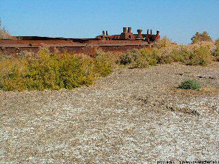
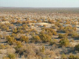
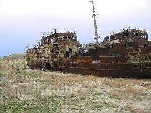
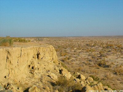
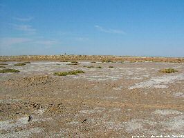
Where long time ago there was the lake basin now it's a really new desert area of the world called Aralkum desert. Uzbeki town Muynak was relevant coastal centre processing seafood, now it's located 50 km from lake coast; picture on the left side shows that which was the lake coast of Muynak town.
The Aral area climate has been modified by water vanishing and now it's arising irreversible and auto-sustaining process so water evaporation increases lake drying and lake drying increases thermal range and water evaporation.
Water salinity is so much high that desert ground is constitued by salty sands exposed to frequent and wild sand-storm propagating dust and sand up till mountain of Pamir, Hindukush and Himalaya too. Moreover using weed killers and pesticides in the past to favorite cultivations made these salt sands heavily polluted and toxic for the people.
Before all that, before the environmental disaster related to this very particular area of the Earth, the Aral Sea had got crystalline waters, sea floor not much deep populated by several fish varieties, florent human and economic activities along its coasts related to fish industry and seafood export. In spite of natural continental climate with very warm summer and very harsh winter, with great thermal range, the Aral Sea valley was on its own way green and mild.
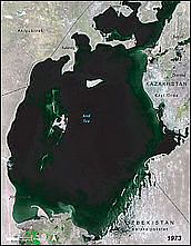
Aral Sea in 1973
